Groundwater Depth Map
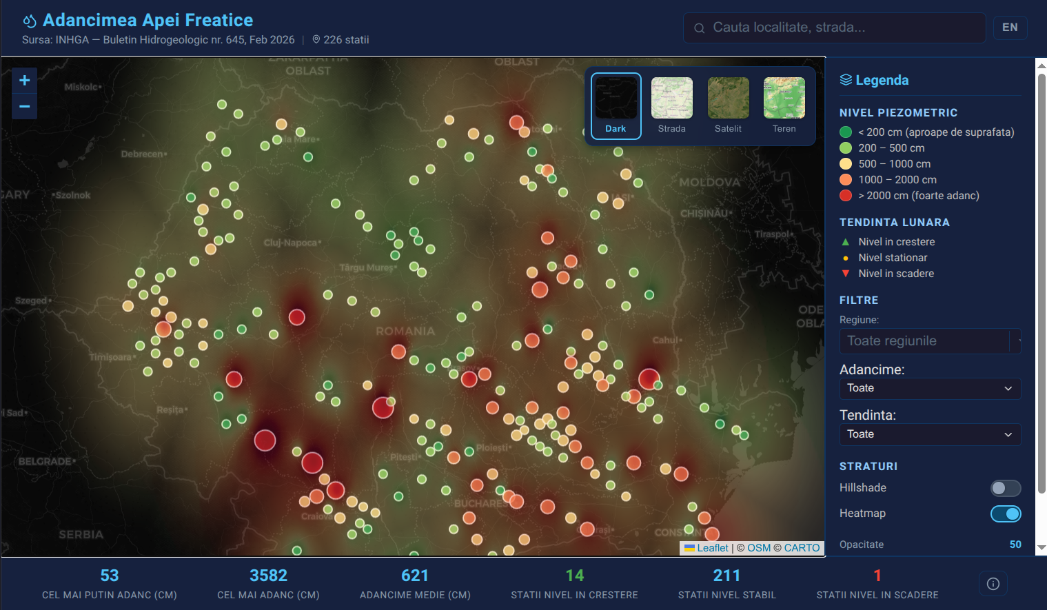
Groundwater Depth Map pulls depth-to-water-table data into one navigable map. The purpose is to help people assess groundwater conditions when evaluating land for building, agriculture, or drilling, especially where this info is hard to find.
The public data offered in the last years has been getting better and better and after quickly building and deploying this small app i found that the Hidrology institute offers a similar tool on their website.
Disclaimer: This tool is not a substitute for a site-specific geotechnical study.
Still, it offers a practical early signal: the depth range to expect in a given area and whether a property might need special foundation or drainage considerations. The main highlights would be that this app offers more view modes for the map, heatmap data and better filters for the existing data.
It's a fast way to reduce uncertainty before spending on formal surveys.
I built this using an AI assisted workflows to move quickly from raw tables to a working map. That meant faster cleanup, faster iteration on layers, and more time spent on the parts that actually help users.
That same approach lets me ship small, focused data tools without long cycles.
Subscribe to get the latest updates

Member discussion