Projects #1
When I started looking for land to build on in the Timișoara area, I ran into something I wasn't prepared for. Not the unfair agents, not the large amount of paperwork, not the difficult negotiations; these I expected. What caught me off guard was how little usable data there is about the market itself.
In most European countries, you can look up comparable transactions, track price trends per square meter, and get a reasonable picture of what's happening in a given area before you commit to anything. In Romania, the infrastructure for that just doesn't exist in any practical sense. The abysmal level that the official public data is available would make any citizen start even to expect foul play. But I digress.
What data exists
ANCPI (the National Agency for Cadastre and Land Registration) collects data from every property sale registered through the land book system. In theory, this should be a goldmine. In practice, what they publish is limited to transaction counts, broken down by county, in quarterly spreadsheets. That's it. No sale prices, no price per square meter, no averages, no medians. Just how many transactions happened in a given county during a given quarter.
This is a remarkably stingy approach to public data. The agency sits on the most complete record of what's actually happening in the Romanian property market and the public gets purely volume numbers in an xlsx file.
The only sources that offer anything resembling price data are private platforms like Storia.ro and Imobiliare.ro. These are useful to a point, but they track listing prices, not transaction prices (except their annual aggregates). Sellers list at what they hope to get, not what they end up accepting. The gap between listing price and closing price can be significant, and there's no public dataset that captures the difference.
The infographics that occasionally surface from these portals or from real estate agencies tell you the average listing price in Timișoara went up 5%, but that number tells you what sellers are asking, not what buyers are paying.
When buyers don't have access to real market data, they negotiate blindly. You have no solid basis to judge if a price per square meter is reasonable for a given area. You rely on agents whose incentive is to close at the highest price, not to give you a balanced view. You end up making decisions based on gut feeling and whatever someone you know paid for their plot a few years back.
This information asymmetry works in favor of sellers who can price above market because buyers can't point to comparable data, and in favor of agents who become the only source of "market knowledge" that really should be public information.
So as a small helper
After spending a good amount of time trying to piece together a picture of the market from scattered official reports and listing portals, I ended up building two tools that try to make some of this data more accessible, even though it does so in a small sense. Neither one is a complete solution, but both address gaps that genuinely frustrated me during my own search.
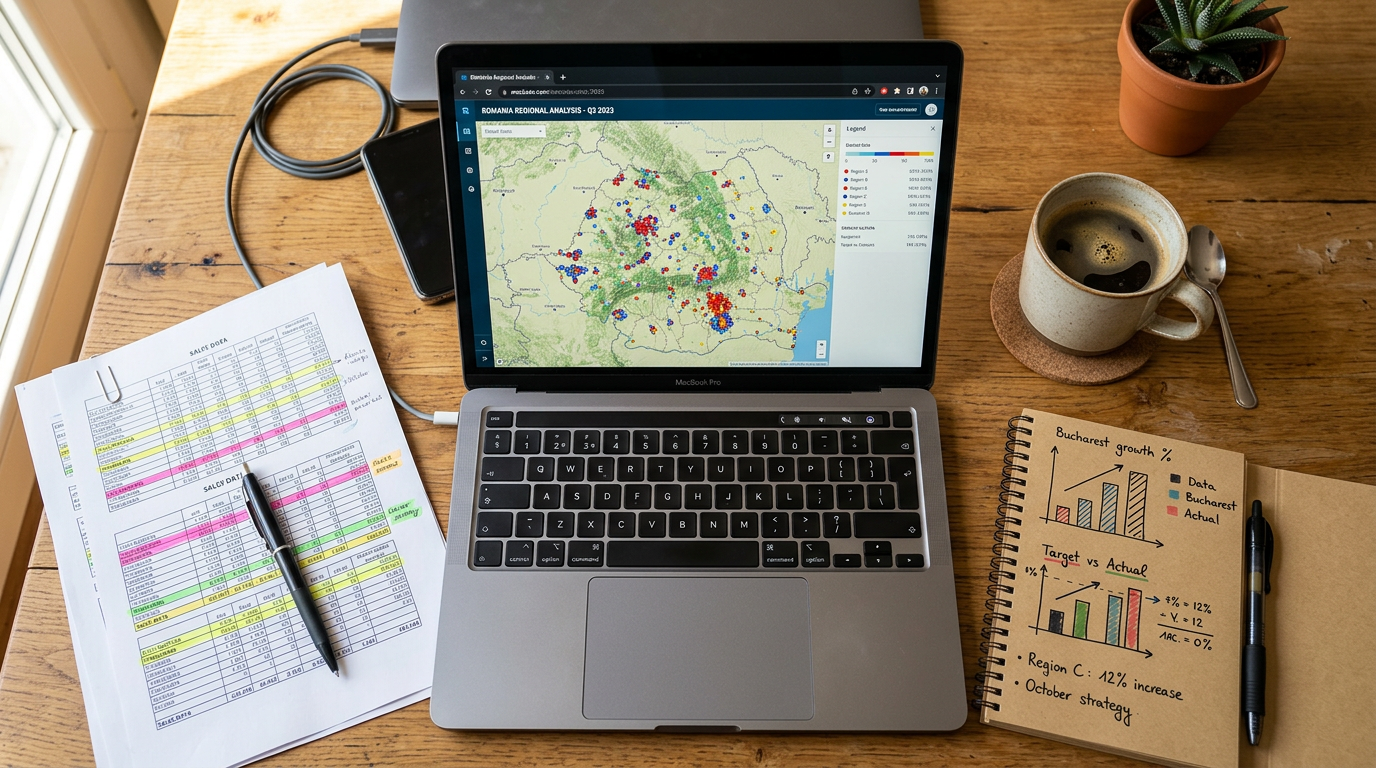
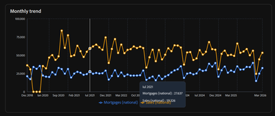
Romanian Real Estate Transaction Statistics
This tool takes the ANCPI transaction data and presents it in a way you can actually navigate and compare across counties, property types, and time periods. I wrote a more detailed post about how it works and what you can get out of it: Visualizing Romania's Real Estate Transactions.
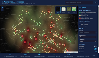
Groundwater Depth Map
A map of available groundwater depth data across Romania, which I built because finding out the water table depth for a specific area turned out to be unreasonably difficult. If you're building, this matters for your foundation and drainage. I wrote more about this one here: Mapping Groundwater Depth in Romania.
Conclusion
These tools are free and open. They're limited by what the official sources provide, and they don't replace professional due diligence. But they're a small step toward making the Romanian property market a little less opaque for regular buyers.
Both of these were built quickly (~2h) using AI-assisted development workflows, and they're the first in what I expect to be a longer series of small, focused tools.
When you can go from "this problem annoys me" to a working prototype in a few hours or a working app in a few days, the calculus changes on what's worth building.
A lot of publicly available data in Romania is technically accessible but practically useless because nobody has taken the time to make it navigable. That's exactly the kind of problem where agentic workflows and fast prototyping make a real difference, and I plan to keep shipping more of these. There's already great work being done in this space:
Transparenta.eu takes ANAF budget execution data and turns it into something you can actually explore with charts and maps, which is exactly what public finance data should look like. The more people build tools like this on top of Romania's public data, the harder it becomes to justify keeping it buried.
If you're buying property in Romania, try them out. If you have ideas for improving them, I'd like to hear about it.
And if you happen to be an institution sitting on useful data locked in spreadsheets, consider that making it accessible isn't an afterthought, it's how markets work better for everyone.
Disclaimer: The applications do not and should not replace due personal diligence: always double checking with official data, not do they replace professional geotechnical studies
Subscribe to get the latest updates

Member discussion